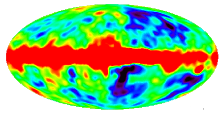
Small variations in the temperature of the background radiation from point to point on the sky are called anisotropies. These anisotropies were first detected by the COBE satellite in 1992. They produced a map of the sky:
where the colors represent temperature on the sky.
To get a better feel for what a map like this means, lets consider a more familiar map:
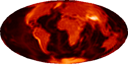
which you can think of as what COBE would have seen if it looked down instead of up! The map here is a 2 dimensional representation of the 3 dimensional surface of the earth, just like the COBE map is a representation of the sky.
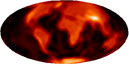
COBE has rather blurry vision and can only see large features corresponding to 7 degree separations on the sky. Here's what the world would look like with that kind of vision:
COBE also has noise in its detectors like you would have with bad reception on your TV. Here's what the world would look like if we add in the same amount of noise

To get rid of the noise, we can smooth the map. This brings out the large features like continents but fine details are lost in the map:
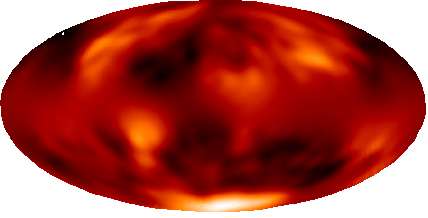
Similarly COBE's map of the background radiation only shows you the large features in the sky and all finer details are lost.
Maps are courtesy of E. Bunn.
![]()